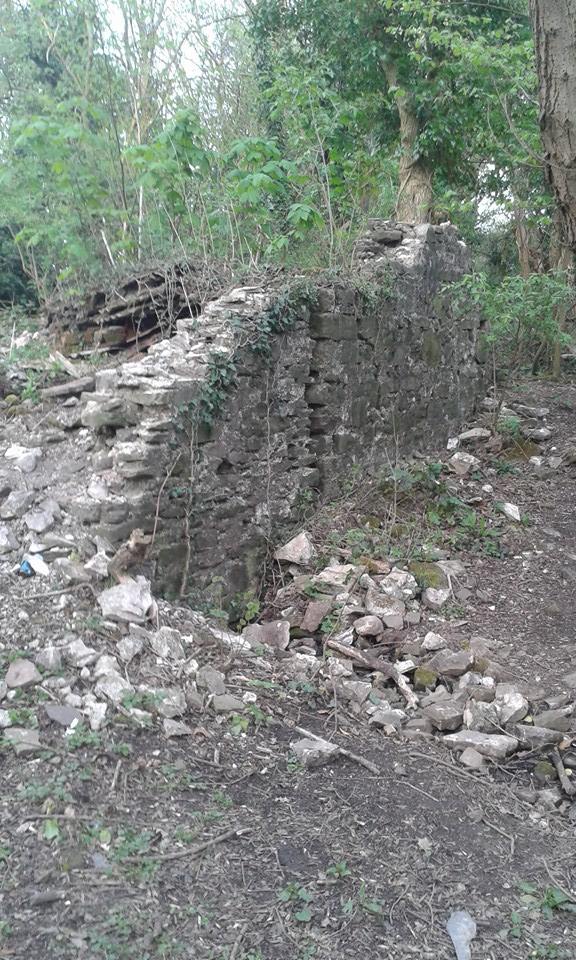
A photo posted by a Cwmbran Life reader has led to an investigation by a historian from Cwmbran. Katie Gibbs shared this photo above and asked:
“Can anyone tell me what this used to be please. It’s over one of the police college fields. It looks like an old bridge and it’s got a little stream going underneath it. It’s like a bashed down old house by it?”
David Standing, a community councillor for Coed Eva spotted the photo and said: “All in all this is quite exciting as we simply do not have many of these buildings left. As the community councillor for Coed-Eva, I have reported the site to the authorities and the community council itself. A few of us are going to visit the site to see what, if anything, we can do
This is his report and photographs
‘David Standing is a local landscape historian who specialises in monastic water systems & agricultural landscapes. He has studied Llantarnam abbey and its granges throughout Cwmbran over a long number of years. His first article on the abbey being published in The Monmouthshire Antiquary XXXII (2016).’
“This report has been produced to answer a member of the Cwmbran community who had a curiosity for walls that remained within the community of St Dials. It was asked if anybody knew what they were as it looked like a bridge traversing a water course.
“Nothing contained in this report is an absolute nailed on certainty. For certainty, a long-term professional excavation would have to be carried out over a considerable period of time.
“The possibilities from first inspections, normally, always produce this sort of report on monastic land (Llantarnam Abbey). It would be easy to suggest that this site is connected to the grange at St Dials although the toponomy may say otherwise.
“It would be highly speculative to say that this was part of a new, and unknown, medieval grange, but the difference in place-names between it and St Dials does not suggest that it was. It certainly deserves more attention as this is the last set of grange remains that were on monastic lands that included Greater St Dials, Little St Dials, Pen-y-Waun (farm), Pen-y-Waun Cottage and the site itself.
“This is normal for Cwmbran as the development corporation systematically demolished ‘old buildings’ to make the landscape possible for the New Town.
“It is easy to criticise them for what has happened to our historic landscape but the pressure was on in post-WWII Britain to create housing, quickly and effectively. Not only that, the study of monastic landscapes were not as understood as they are now.
“Also, I apologise for the report, I can’t include all of the possibilities and lots of it will probably change.
“This is what I have gleaned from the initial site visit.
“The walls that are left in the wood belong to a farmstead that was called Little Pen–y–Waun (head or top of the meadow or hill). Given its location, I would go for Top of the Meadow. Monastic communities were agriculturally based and Llantarnam was no different. Meadows were normally left to grow unchecked so they could produce of hay.
“The width for the majority of the walls is 18 inches (457mm) and indicate, from that size alone, that they were built sometime prior to the Industrial Age in the middle of the 18C (1760). However, there are indications of the site being earlier than this for a number of reasons.
“Firstly there is at least one wall that is nearly a metre thick (39”- 990mm), this could place its construction date to the medieval period. As Llantarnam was founded in the late 12C this should not be a surprise. The second comes from inspection of the lime mortar. As a general rule of thumb, the lighter (or whiter) the mortar, along with the lack of aggregate, the earlier it is. It is important to remember this is only a general rule of thumb.
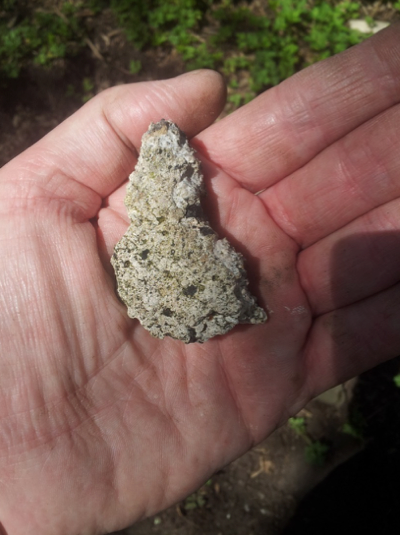
“There are various types of mortar within the site; the earliest is generally white with small charcoal inclusions (Fig 1 below- possibly late medieval (1400-1485), through to a light sandy brown colour (possibly Tudor 1485-1603 – not shown); a creamier white mortar with a high charcoal & sand inclusion rate (late 17C onwards – not shown) through to black (late Victorian 1850- 1900- not shown).
“This is not unusual for a farmstead as they were expanded or repaired on quite a regular basis and ties in with the cartographic evidence of expansion. That happens when farms are in a high-quality agricultural environment, which Cwmbran is.
“There is visual evidence for the structure being re-built on an earlier structure. The word re-built could be changed to extended or expanded.
“On first inspection it appears that the additional structure was initiated for the incorporation of the water supply as it was enveloped into the fabric of the expanded building. This is not unusual but it is impossible to state what the use of the water was for. Lots of farmsteads had small water wheels.
“Their use ranged from sharpening wheels (knives, tools etc.), to the cutting of timber, to the grounding of grain and other produce – their use was interchangeable. It did not have to be for an agricultural mill wheel. The water supply could have been for something as simple as a drain for kitchen waste, or even human waste (a toilet).
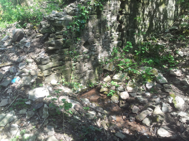
“It should be noted that the water was intentionally incorporated into the structure (Fig 2). That can be stated from the fact that you wouldn’t build on top of a water course. If the water course from the spring had changed direction it would have hit, and then flowed, around the building.
“Not only that, its resultant tail race from the building is capped, by a presumably larger than can be seen, flagstone lintel (Fig 3).
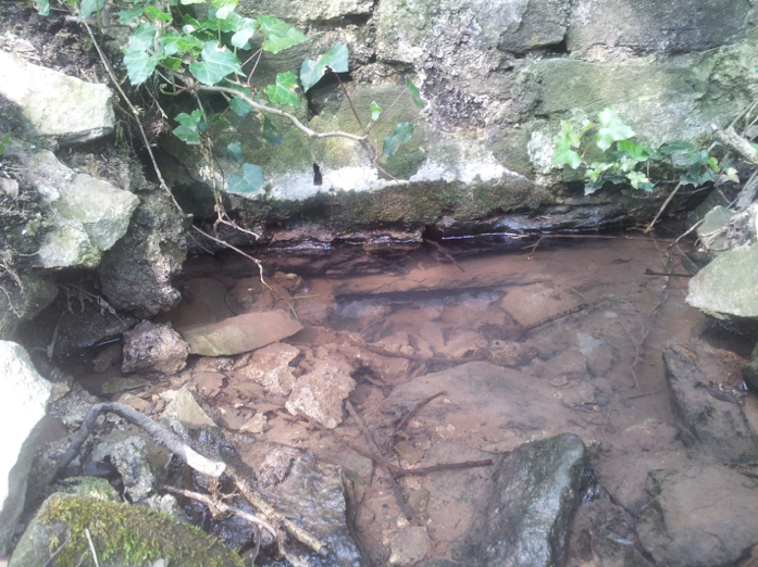
“Tail race implies that the water had been used and discarded but this water source, emanating in St Dials, was actually fed into the Dowlais Brook after flowing through Old Cwmbran and Oakfield. It is an incredibly long managed water system that smacks of Cistercian involvement. They were masters of water management.
“The mortar, walls and cartographic evidence are not the only evidence on the site. There is a high quantity of roofing material scattered around on the floor (Fig 4). These range from various sized stone roofing tiles (possibly indicating earlier maintenance), black glazed (both inside and out) ridge tiles, slates, corrugated iron and asbestos. Obviously, the stone roof tiles are the ones to try and date, but my knowledge on them is sadly lacking. I will endeavour to get up to speed regarding them. Please accept an apology for that.
“Obviously, the stone roof tiles are the ones to try and date, but my knowledge on them is sadly lacking. I will endeavour to get up to speed regarding them. Please accept an apology for that.
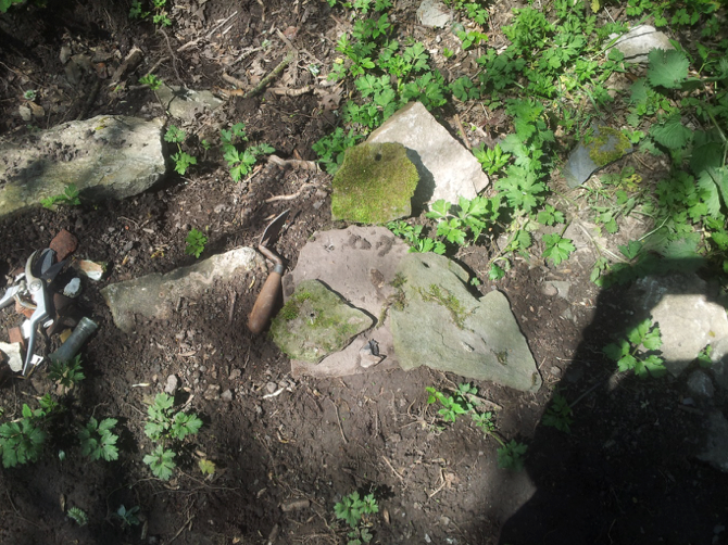
“There was also an assemblage of pottery. It was predominately Victorian but at least one sherd produced a date range from the medieval period.
“One of the main features is the oven (Fig 5) which is visibly protruding from its western wall. It is big (the biggest surviving one in the Cwmbran community without doubt) and ties in with an oven excavation on a site near Trelleck (also in Monmouthshire) that really pushed the boundaries of investigation.
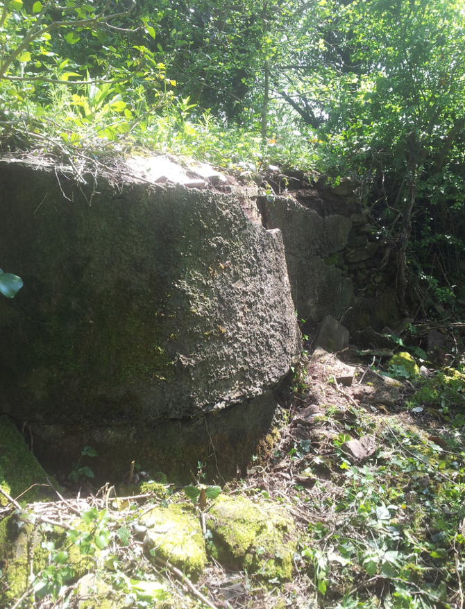
“That was dated to the late 16c and there is no reason, from the evidence presented above why this building cannot be dated to the same period. However, these things can change as more evidence is uncovered.
“May I thank Katie Gibbs for bringing this site to our attention.”
