Fancy going for a gentle walk along the side of a motorway? Stay with me.
When Cwmbran is so close to Pontypool Park, Twmbarlwm, Bannau Brycheiniog National Park (Brecon Beacons) and so many stunning places to explore, why would a stroll beside the M48 be appealing?
Because it’s one of those things you do just to say you’ve done it. A photo next to the Pen y Fan sign might get you more likes on Instagram, but this unusual walk has a charm of its own.
For starters, it’s a bit quirky as who would choose a tarmac path next to speeding cars (few were sticking to the 40mph limit) over a countryside walk?
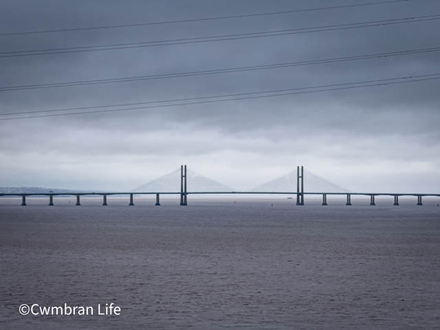
Most people from Cwmbran use the Prince of Wales Bridge – the Second Severn Crossing – to get home. I bet some readers don’t even realise you can walk (or cycle) across the original Severn Bridge, the one linking South Gloucestershire and Monmouthshire.
A fun fact: the crossing is actually more than one ‘bridge’. The Severn Bridge end at Beachley, then becomes the Beachley Viaduct, where it crosses the train line, and then the Wye Bridge for the final stretch into Chepstow. All three are part of the Severn Crossing – the same length of road, but exactly the sort of thing that pops up in a pub quiz.
Where do you park to walk across the Severn Bridge?
Visit Monmouthshire recommends parking at Thornwell Football Club (NP16 5GH), a short walk from the bridge. That’s where we started. From the car park, turn left, then left again into Caerwent Lane.
This leads to a graffiti-covered tunnel under the M48. The first artwork you’ll spot is “Severn Bridge Parkrun”, marking the start of the weekly 5km event. Take a moment to enjoy the artwork before turning left towards the Wye Bridge and the start of your walk.
The bridge can close in poor weather, so check ahead. If it’s shut, gates will block your path.
Visit Monmouthshire says the walk is five miles there and back; our watches suggested slightly less.
We stopped and took a photo of the blue motorway sign for Cardiff. Newport and Chepstow. It’s huge!
What the walk is like
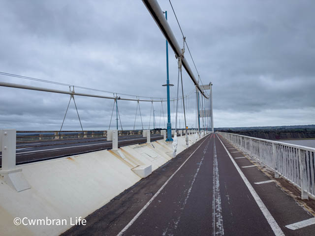
Did we feel safe? Yes, but it may not be one for small children. We took our dog and (obviously) kept her on a lead. The shared path is wide, though the traffic and the wind sweeping along the estuary make it noisy – you’ll need to walk close if you want to chat.
The slope is gentle, and the views across to the newer bridge are stunning. Standing beneath the tall towers and looking up feels unexpectedly special.
Make sure you wear sensible clothes in case of any changes in the weather. The estuary is very windy!
The crossing was officially opened in 1966 by Queen Elizabeth II and became Grade I listed in 1999. Look out for the plaques, including one remembering the ten men who died during construction and later strengthening works.
Where are the nearest toilets?
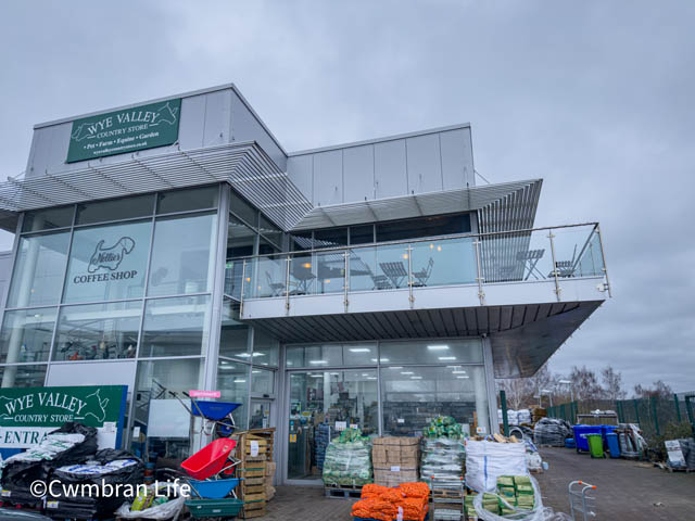
Before starting, we stopped at Nellie’s Coffee Shop at the Wye Valley Country Store – just three minutes from the football club – for coffees and a toilet break.
Once you reach England, you can continue to Moto Severn View services for refreshments. Google Maps said it was another 15 minutes, but we turned back.
After returning to the car, we headed into Chepstow where we found free parking for two hours in the Welsh Street Car Park. The Three Tuns was fully booked (no surprise on a Sunday), but The Boat Inn by the River Wye had space. A cracking Sunday dinner rounded off the day before we headed home for a well-earned nap.